 Personally I really don’t want to repeat everything word for word that you can find on Wikipedia, especially since I am not an encyclopedia (despite people’s claims otherwise), however I feel that I should at least give some background. The road itself was conceived near the end of World War One when the government was trying to work out what to do with all of the soldiers that were returning home. Okay, they did suggest that they could put them to work constructing roads through the country, but from what I could see there was really no economic benefit to the Great Ocean Road itself. Either somebody came up with the idea of creating a tourist attraction, or they wanted to give them some ‘busy work’. It is not as if the towns on the coast could not be reached by inland routes, and even today you don’t get trucks travelling along here (only huge buses full of tourists). Hey, don’t get me wrong, there is nothing bad about building a tourist attraction, but I would hardly suggest that there was any real economic benefit beyond charging people a toll to risk their lives traveling between Lorne and Apollo Bay (yep, the road was pretty hairy back then).
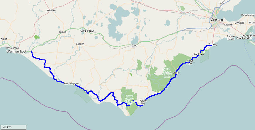 |
| I better show you a map of the road |
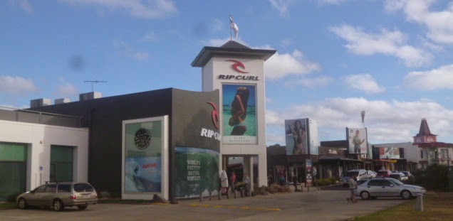 |
| There are no shortages of surfing shops here |
The Boring Bit
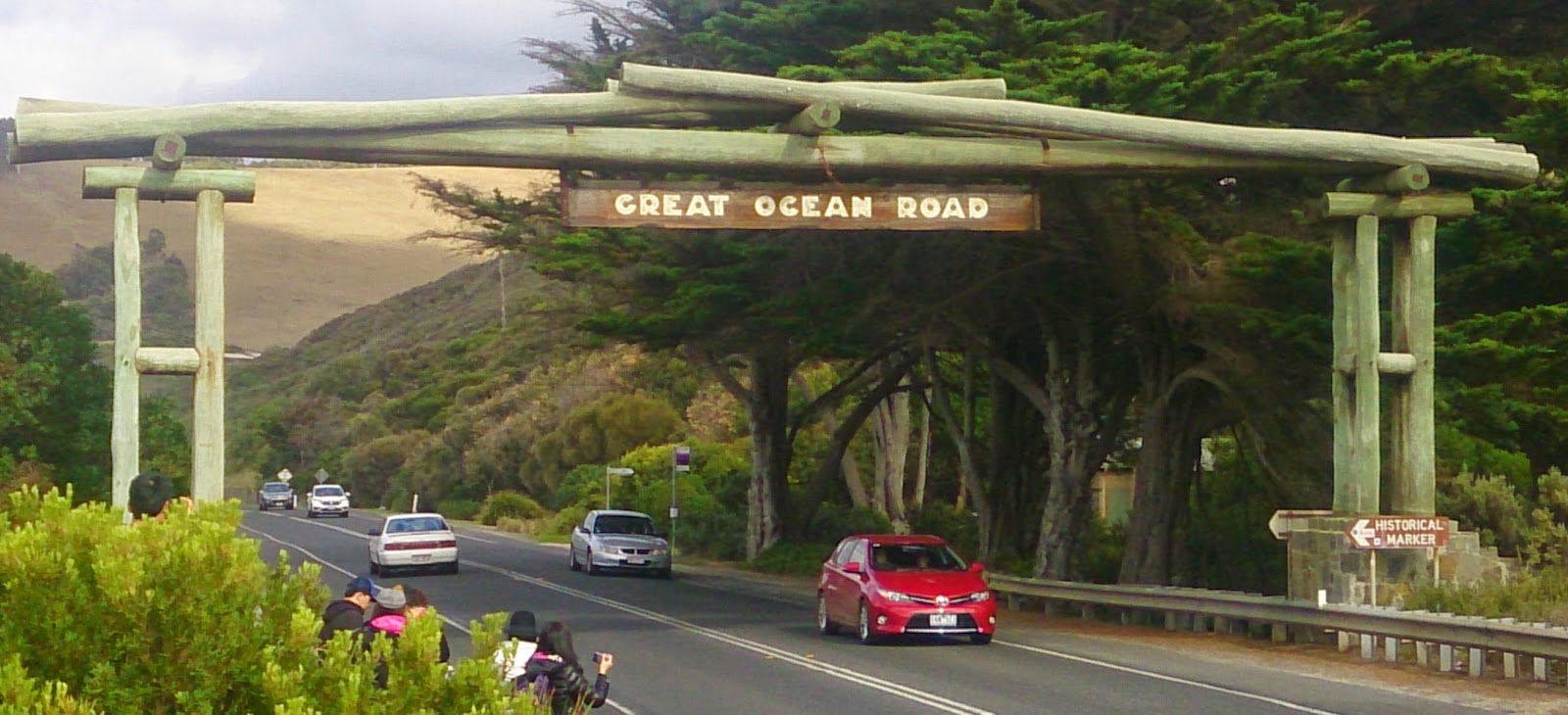
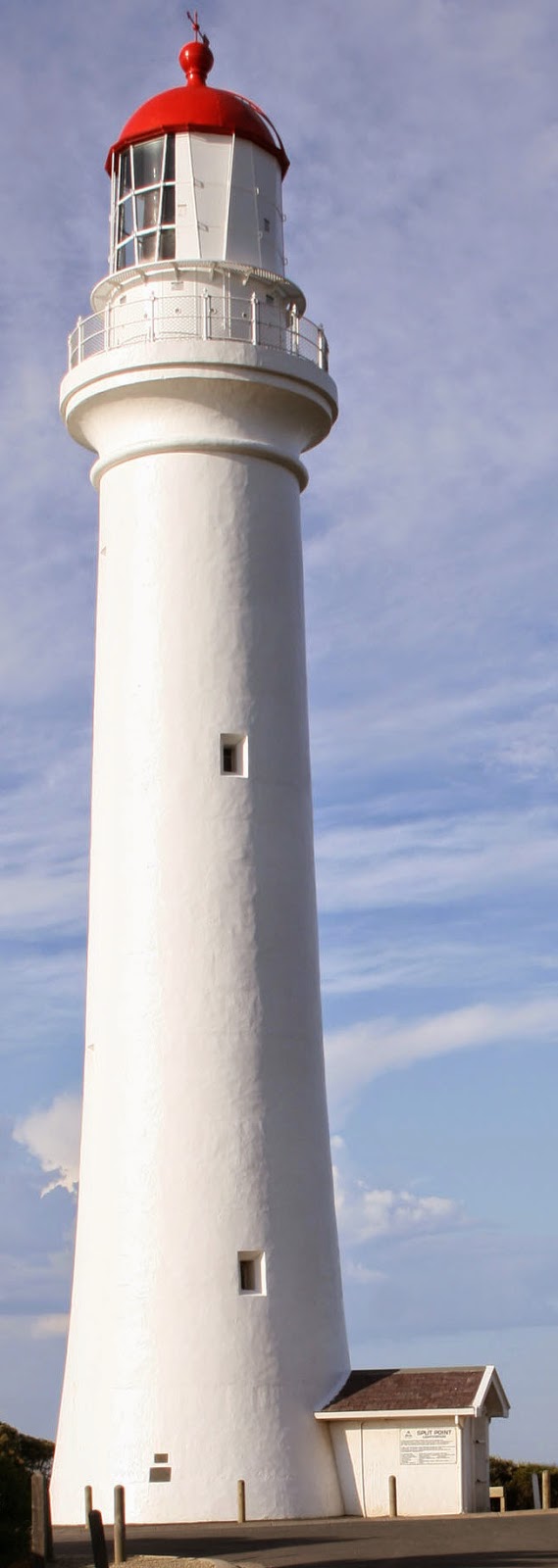 So, after you leave Torquay you then travel along what I consider the boring bit because, well, it is actually quite boring. It is just like your everyday country road (except for all of the tourists making the journey to the less boring bits). Okay, it does get a little better after you pass through Anglesea (where there is a caravan park, a pub, an estuary for watersports, and the holiday makers that always come down here for a holiday), but it still is a little boring. Okay, there is a really cool lighthouse at Airey’s Inlet (and you can even go on tours), and there are some houses that are probably worth more than the average minimum wage worker would ever make in their life time, but that is about it. Okay, there is also the Eastern Arch (which is the photo that I have used with the title of the post) which used to be the toll gate where the government attempted to recoup the costs of the road from unsuspecting tourists, but as I have suggested, that is pretty much about it. The road doesn’t really get all that interesting until you pass through Lorne.
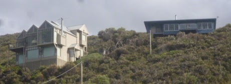 |
| Probably spends most of the year empty |
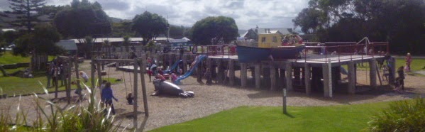
Lorne
Well, before you hit the interesting part of the road, you first must pass through Lorne, and that can be a real challenge during the busy season. As I mentioned, I have been down here four times, and two of those times have been during the high season, meaning that the traffic literally slows to a crawl. Oh, and you can’t take a short cut by hitting the side streets because they are all dead-ends – so no easy way out there either. Anyway, Lorne seems to be one of those towns that serves the higher end of the community. Walking along the foreshore the town seems to drip with class. There is also a really trendy element to it as well, with classy shorefront cafes and shops selling stuff that would only appeal to those who wish to be an individualistic conformist. Look, Lorne isn’t actually a bad place, and I must say that they had a pretty impressive playground for the children, but it also seems that staying here for any period of time can be a bit of a drain upon your wallet – at least during the high season.
 |
| It makes me not want to grow up |
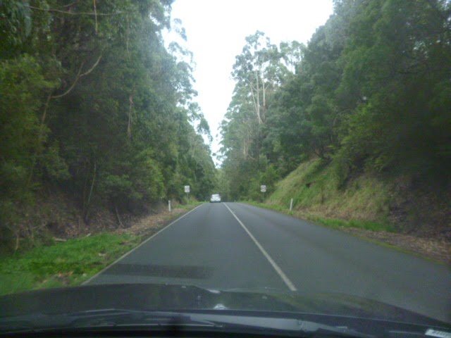
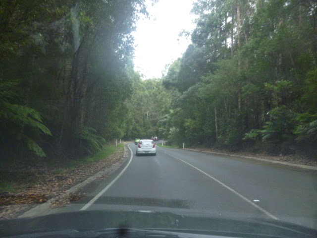
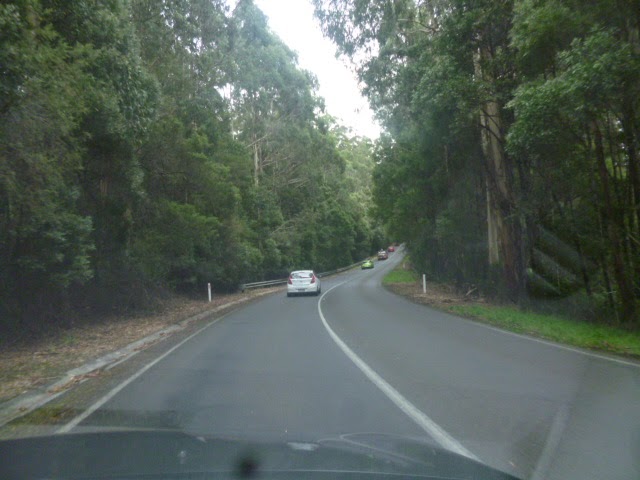
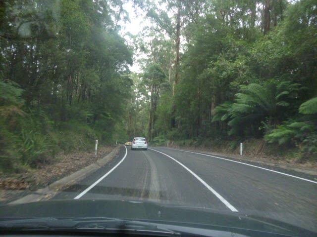
Cliff Drive
After you managed to escape the monumental traffic jam that happens to be Lorne you then enter one of the more thrilling parts of the trek along the Great Ocean Road – the section that I refer to as the Cliff Drive. The reason that I refer to it as such is because the road runs along the side of the cliffs – some parts are quite high up while other parts are much closer to the shore. Anyway, while I took a bunch of photos along this route, I realised that a Youtube video would be much, much better, so here is the video that I uploaded earlier:
Oh, and before you tell me off for driving and using my mobile phone at the same time, I assure you that the person who is holding the camera is my friend sitting in the passenger seat.
Anyway, this long, narrow, and very windy road is probably my favourite part of the journey, simply because I just love driving along long, narrow, and windy roads, especially if the view is quite scenic, as it is along here. There are also quite a number of spots where you can simply stop the car and get out and simply take in the view, which is what I generally always do when I am driving along this road. In fact it was after that first time in early 2000 that gave me that attachment to this route back to Adelaide, and it is why, when I had the opportunity, that I would travel along here. The first two times that I drove down here we actually managed to do so without taking a break, but then again I had others in the car so we could share the driving. The other times were either by myself, or I was simply not going all the way to Adelaide.
Another thing that I saw here were the waves crashing against the rocks, and I thought that it would make a very good relaxation video, so here is one of them that I took.
 |
| I think the photo is supposed to curve around. |

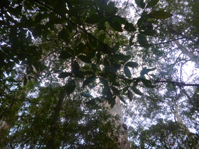
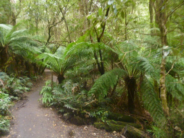
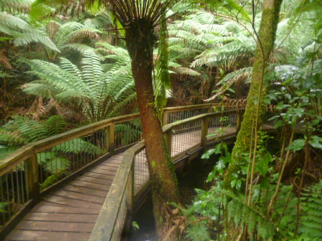
I probably should point out that if you are planning on taking this trip, make sure that there is enough petrol in your tank because there aren’t any petrol stations in this jungle, and your Telstra mobile phone won’t work – actually, come to think of it I did post a Facebook status update while wandering through here so ignore what I just said.
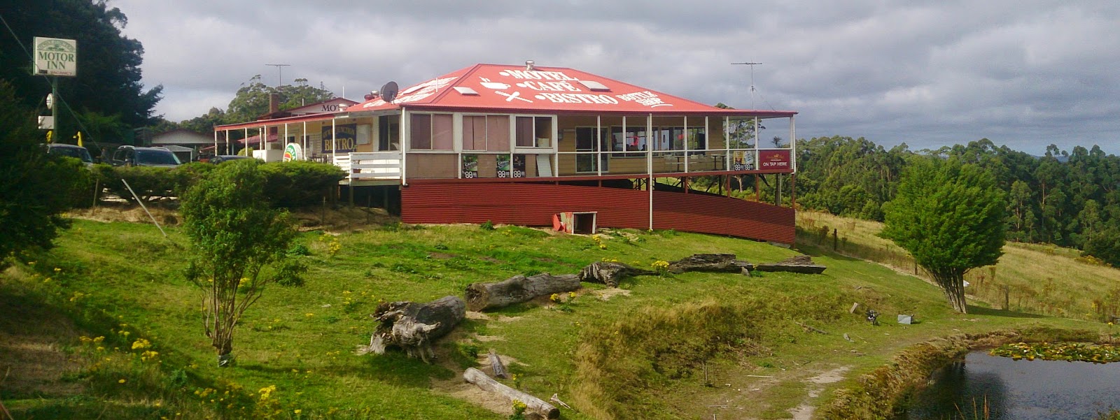 |
| Not exactly what I imagined a bistro to look like |
Laver’s Hill
When you emerge from the jungle, or forest, or whatever you want to call it (some people, and signs, call it a jungle, others call it a forest – such as the sign at Laver’s Hill which proclaims that this is where the forest meets the sea), you come to this small collection of buildings known as Laver’s Hill. In a way it is like one of those places where you simply want to escape to from the modern world because, even though they do have mobile phone reception, it simply seems as if time has pretty much stood still. It is like the forest (or jungle) works to keep progress at bay – and in some places that is not necessarily a bad thing. Mind you, for what is in effect a handful of buildings, I am surprised that there are two pubs. Well, one if you don’t call the old rustic building connected to the motel which carries the name bistro, which I must say I found quite odd because it really didn’t look like a bistro. Mind you, since pretty much all of the suburban pubs have bistros I have come to expect little from the term, but then again this is a really nice, and old, building in the middle of a pastoral setting, which honestly, is not some place I would expect to find a bistro (at least in the suburban pub use of the term).
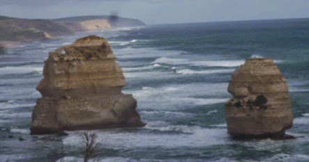 |
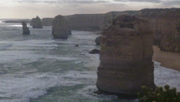
| Two of the Seven remaining Apostles |
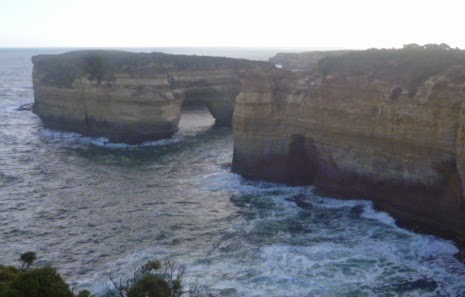
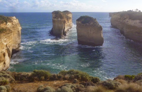
The Attractions
A short while after you leave Laver’s Hill you come to Princetown and just beyond there the land begins to flatten out. Not so much that you have rolling plains drifting down to a beach, but rather rolling plains ending in a sharp drop of some fifty or so meters (I don’t know exactly how far, but it looks pretty high) to the beach. It is along here where there are a number of attractions that have formed over time due to the waves crashing against the shore.
By far the most popular, and well known, site along this section are the Twelve Apostles. Well, actually seven of them, though through some imagination you could probably work out where the other five are located (I try that every time I come here, though I only manage to get eight of them, and that is including the two that have fallen down – one of them in my lifetime).
I did try to get a panoramic shot of all of them, but due to the amount of people swarming around the sight, and the fact that they are at a 180 degree angle, it was just not possible, so here is a photo of the others.
 |
| It would look even better in the middle of a storm |
This place is certainly the highlight for many of the tourists, and in fact when we came here they even had people directing the cars. They also offer 15 minute helicopter rides (for $145.00 per person), though I doubt they fly too low (considering what would happen if one of the helicopters were to crash).
 |
| These panorama shots do turn out a little odd |
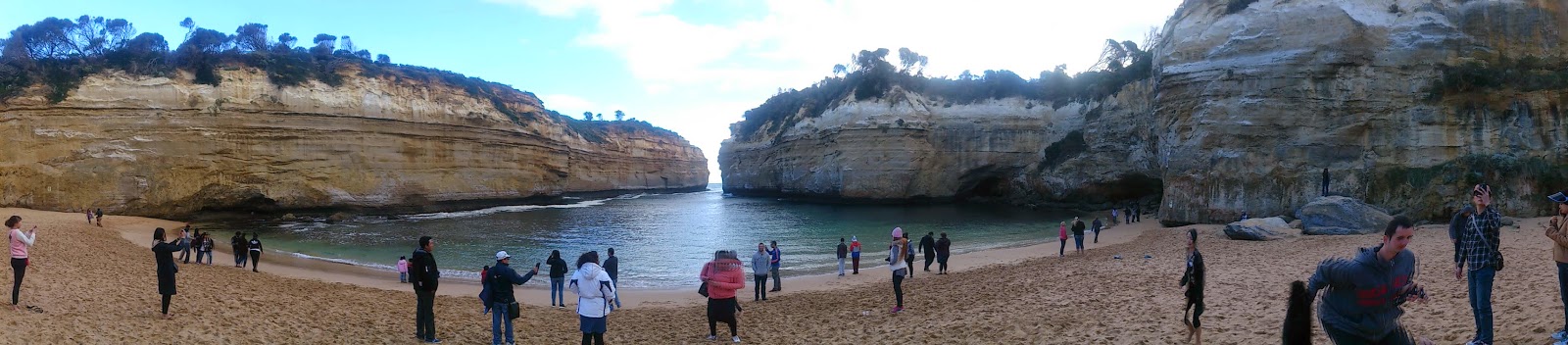
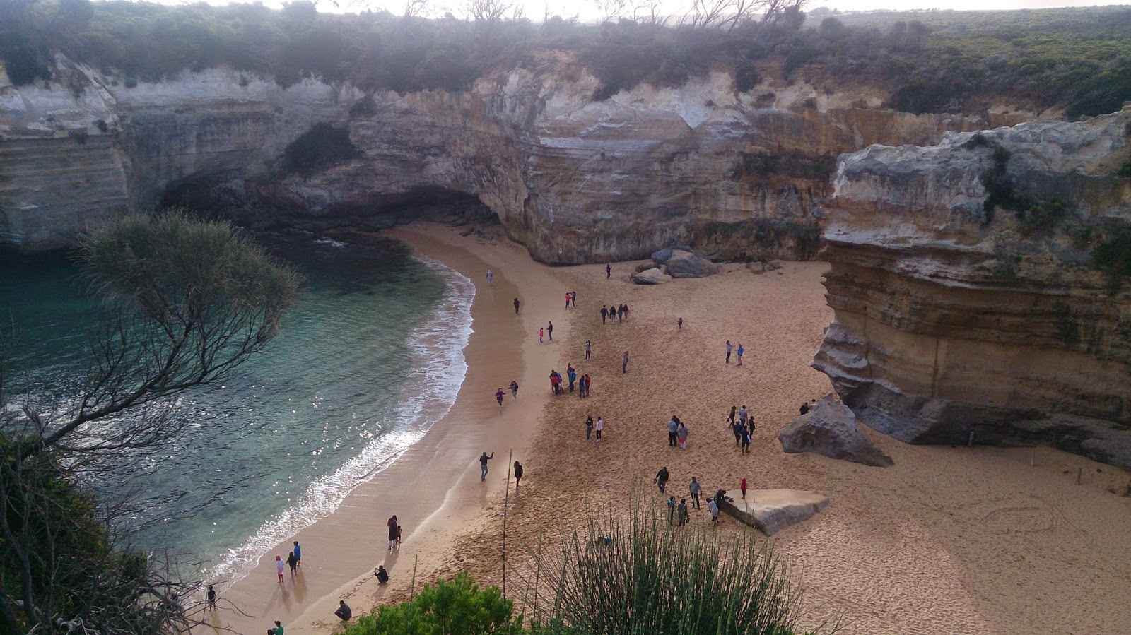
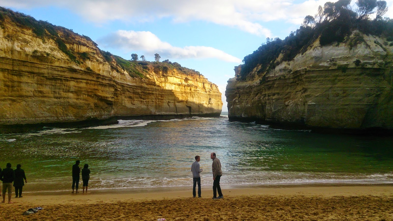
Loch Ard Gorge
Sure, the Twelve Apostles may be the star attraction along this stretch of the road, but there are quite a number of stops that I believe are much, much better – such as Loch Ard Gorge.
The section of the coast is known as the Shipwreck Coast namely because lots of ships (18 I believe) met their fate here while attempting to reach Melbourne, and looking at the ruggedness of the cliffs I am not at all surprised. Anyway, if you have never heard of the Loch Ard, by the time you have visited this location you will have, since it is one of the most famous shipwrecks that occurred here. The ship struck a reef in the area on 1st June 1878 and all but two of the passengers and crew were killed. The two survivors, a cabin boy and one of the passengers, came ashore in this gorge. A cemetery commemorating those who lost their lives is also nearby.
While the cloud of a tragic loss of life at sea hangs over this area, all I can say is that this is probably one of the best beaches that I have ever visited. Okay, there are probably better ones in more tropical climes, but as a beach this is still pretty cool. I even remember coming down here as a kid one summer and going for a swim, as well as clambering over the rocks and exploring the cave. Actually, this time I clambered over the rocks and explored the cave, which goes really deep into the cliff. Mind you, you better be careful that the tide doesn’t come in because you might find yourself trapped.
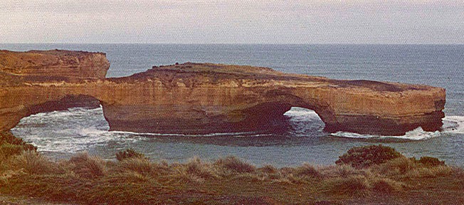
London Bridge and the Bay of Islands
Since it was starting to get late, we unfortunately had to skip a number of the other attractions, such as the Grotto (which is really, really cool). However, we did stop off for a short time at London Bridge. Mind you, it doesn’t really look much like a bridge any more because, well, like London Bridge, it fell down. Actually, the last couple of times I came here I would take a photo and upload it to Facebook with some smart comment pertaining to such.
 |
| It still sort of looks like a bridge |
I still remember when I came down here as a kid and we walked out over the bridge. Even at that time I wondered what would happen if it fell down while we were still out there. In fact, on 15th January 1990, two poor unsuspecting tourists discovered just that when the span connecting the mainland collapsed. They were eventually rescued by helicopter, and the site now has the dubious connection to its namesake.
 |
| And once again Wikipedia has delivered the goods |
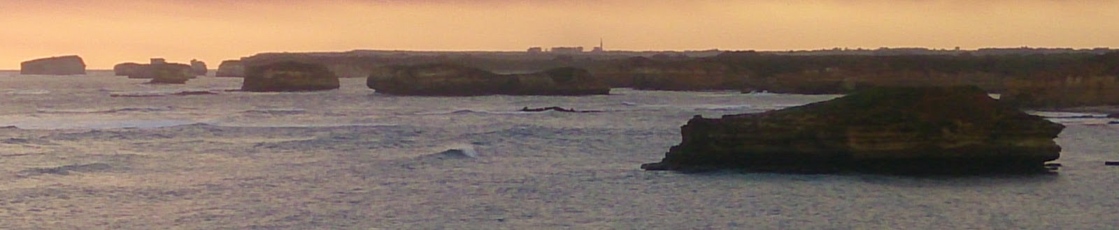
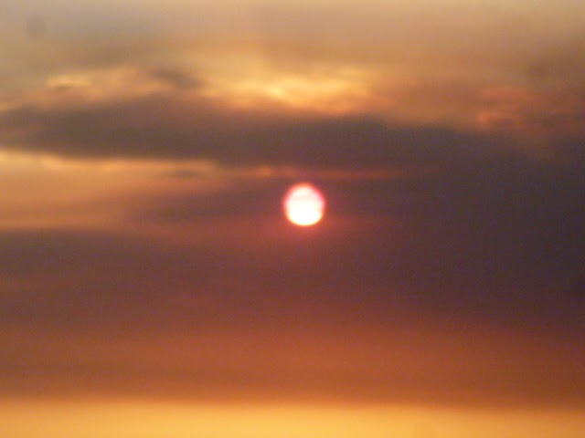
A little further on is the Bay of Martyrs (also called the Bay of Islands, but the Bay of Martyrs sounds so much better). I’m not really sure why they called this place the Bay of Martyrs, but I am sure that I read somewhere that it had something to do with the number of shipwrecks along the coast. Mind you, that sounds a little odd, considering people dying due to their ship sinking would hardly be called a martyr.
 |
| It looks even better at sunset. |
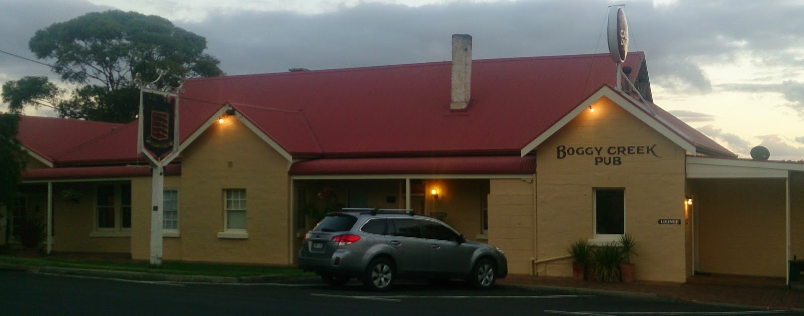
Boggy Creek Pub
So, the road now turns inland where it eventually meets up with the main highway between Warrnambool and Melbourne. However, before you reach the turn off you will see a sign pointing to ‘The Historic Boggy Creek Pub’. Well, anybody who knows me would know that I would never turn down a visit to a pub, especially an historic pub, so I switched on the blinkers and drove down the country road.
 |
| Certainly a popular tourist attraction |
The pub that I discovered was actually your typical, ordinary, country pub – not that there is anything really all that typical or ordinary about country pubs. However, this was certainly full of all of the local characters, as well as a couple of tourists take looked decidedly out of place (as did we city folk). Mind you, it was still quite a nice place, and is certainly located in some really tranquil surroundings, so it is definitely a good place to stop over on a long road-trip.
So, there we go, the Great Ocean Road, or at least a part of it. Unfortunately there is probably way too much to see on a simple day’s journey, and there are a number of places that I reluctantly skipped, if only to take a photo of the Boggy Creek Pub while there was still some daylight. Maybe another time in a couple of years I will come down here and stop by at some of the other places along the route, and then share my further adventures with the world.

If you wish to use this work commercially please feel free to contact me.
Great Ocean Road Map source: Gryllida use permitted under Creative Commons Attribution Share-Alike 3.0 Unported
Split Point Lighthouse source: Mike Lehman, Mike Switzerland use permitted under Creative Commons Attribution Share-Alike 3.0 Unported
London Bridgh source: Philipist use permitted under Creative Commons Attribution Share-Alike 3.0 Unported
